 Chris Korte's New Zealand Genealogy Project
The Waioeka Gorge
About page
This page provides information about the history of the Waioeka Gorge district and the road through the area, State Highway 2 from Matawai to Opotiki. Members of the Redpath family (Jack Redpath, Stuart Redpath and his children) have lived at Wairata in the Gorge since the area was made available for settlement in 1907 and are one of the few original families still residing there.
Many of the men who worked on the highway construction lived in Matawai where I grew up. Our family traveled through the Waioeka Gorge regularly from Matawai to Opotiki when I grew up for shopping, doctor visits and to visit the beach and family.
If you can provide additional information, or corrections, please contact (see Info menu).
Location and Brief History
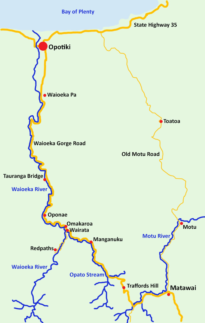
The Waioeka Gorge cuts through ranges of steep-sided hills rising from 400 metres near Opotiki to 1000 metres inland. The hard yet brittle greywacke has been showered with volcanic ash and pumice over thousands of years. Vegetation includes canopies of tawa, rimu, miro, totara and nikau palms, together with cover of fern, manuka and kanuka.
The map shows the Waioeka Gorge Road, between Opotiki and Matawai, part of State Highway 2. This is the main highway north of Gisborne, the alternative being around East Cape on State Highway 35. The map also shows the route of the Old Motu Road, the route between Gisborne and Opotiki through Motu before the Waioeka Gorge Road was opened in 1931.
From Opotiki, the highway enters the Gorge at Waioeka Pa (9 km, 20 m altitude) and follows the Waioeka River upstream to Wairata (42 km from Opotiki, 120 m altitude). The road then follows the Opato Stream before crossing it (400 m altitude) and making a steep ascent up Traffords Hill (700 m altitude). From the top of Traffords Hill the road descends down to cross the Motu River (540 m altitude) and continue on to Matawai (72 km from Opotiki) and Gisborne (144 km from Opotiki).
The map also shows the location of places mentioned on the page and in photographs.
Brief History
Maori accessed the densely bush-covered landscape of the Waioeka Gorge for hundreds of years. They created tracks and used the often treacherous Waioeka River to access gardens and establish temporary settlements on its banks.
Most of the Waioeka Gorge was settled for farming in the early 1900s, with sections being 700 to 1500 acres. Rapid progress was made felling the bush and establishing pasture for livestock. However the steep terrain, poor soils, wet climate, rapid regeneration of fern and bush and erosion made it difficult for farms to remain viable. The slump in wool, sheep and cattle prices in the early 1920s and 1930s saw many of the Waioeka farmers abandon their farms and everything they had worked for. The forest has been regenerating ever since on the abandoned farmland with much of it now in the Waioeka Scenic Reserve.
With European settlement at Opotiki, a dray (cart) road from Opotiki to the mouth of the Waioeka Gorge was established by the early 1900s. Access from Gisborne became a priority and so a rough track was formed through to Wairata in 1909. The track from Wairata to Matawai was completed in August 1912. By the end of World War I (1918), a road from Opotiki had been formed reaching Oponae, with the track on to Matawai. It was hard going, but eventually the road from Oponae to the Motu River was completed in 1931. Work began in 1950s to convert the narrow gravel road through the gorge to a sealed two-lane highway, with the completed gorge highway being officially opened in 1962.
The Gorge Track

THROUGH THE WAIOEKA.
UNRIVALLED SCENERY
"As flat as a billiard-table all the way," was the declaration of a man who walked from the Waioeka through to Matawai a couple of summers ago. To apply such a description to this route across the Raukumara range would be ridiculous, as it comprises some of the steepest portions of this mountain chain. The track, however, that has been cut through by the Government road officers during the past two or three years is a triumph of engineering skill.
Except for the steady climb from the Motu Valley road through Morice's and Cattle Creek across the watershed, the journey on to Opotiki is down hill practically all the way. The summit is probably a little over 2000ft high, from which one gradually descends in the distance of 40 miles that stretches thence to Opotiki.
For the most part the hill-tops are comprised of steep birch country, and in places the hard slatey rock is close upon tho surface. Areas such as this should certainly be preserved for its great scenic value, as the ride through the Waioeka for its attractiveness is unrivalled anywhere on the East Coast. For about 30 miles the track passes almost entirely through virgin bush country, and following close the meanderings of the Opato stream and then the Waioeka river, the scenery is superb, rivalling even some of the beauty spots of the upper Wanganui. Why Gisbornites should wish to journey to the West Coast of the islands to inspect its scenic beauty when a holiday ride through a country of such grandeur is so easily arranged is inconceivable. Proceeding along the narrow rocky ledge, hewn out of precipitous bluffs, perched at a dizzy height above the stream, one is surrounded by hillsides of magnificent bush and ferns, so high and steep in places that it almost gives one's neck a twist' to attempt to follow the skyline.
A couple of years ago scarcely more than a pig track connected up the two districts, but to-day there is a road along which one may canter with ease. A small gang of men are at present employed opening up a four-foot track from the Opato stream to join a similar track that extends in from the Matawai side. Some distance further on at Manganuku the Opato has been spanned by a useful and substantial suspension bridge capable of carrying its decking crammed full of loaded pack horses. It is 120 ft in length, and has only recently been completed, the timber being sawn on the spot.
A few miles lower down one strikes the Waioeka river (30 miles from Opotiki), a comparatively broad expanse of beautifully clear water. Half a mile up from the junction it is spanned by a suspension bridge of 180ft in length, giving access to the settlers across the river. It is a splendid piece of work and cost about £450. A third bridge is to be erected at the junction, but its construction has been delayed by the contractor throwing up the job.
The Waioeka-Opato track was opened up for the purpose of providing a shorter stock route from Gisborne, and has been freely used for this purpose. Stores have been drawn from the Gisborne side by many of the settlers in the upper district, who have also taken their sheep to Matawai for shearing. The track has slipped away in places, leaving a rather narrow ledge, and this was accentuated (as seen by a Herald representative who rode through last week) by fallen trees that had come down during a fire, whilst lower down a heavy rainstorm had caused numerous slips.
Source Poverty Bay Herald, 18 January 1913, Page 3.
The swing bridge at Wairata referred to in the article is actually 2 km (1.4 miles) up the river from the Gorge Road and is still used by the Redpath's to access Redpath Road and their property. Charlotte Cameron (nee Redpath) commented that at night the bush was lit by glow worms that lived in the forest canopy, at the time the above article was written.
The Gorge Road
As indicated above a road suitable for motorised vehicles through the Waioeka Gorge to Matawai was completed in 1931. Several bridges were constructed along the route over the larger streams, including the single lane Motu River bridge completed in 1931 that eliminated three crossings. It was reported in 1932 that there were 25 open watercourses on the Gorge Road, and 15 signs marking the worst of the watercourses had been erected. The Poverty Bay Herald published the following reports on the completed road, noting the splendid scenery and the improvements over the Motu Road alternative.

5 October 1931
There appears to be no question but that the new Waioeka road will be the main highway between the two bays, writes the Opotiki correspondent of the Auckland Star. The new road has one big hill about three miles in length near the Matawai end. Apart from this, it is almost devoid of grades, in striking contrast to the famous Opotiki-Motu road, with its numerous tortuous climbs. The Waioeka road is also being made much wider than the Motu road, and the width on the, only hill is ample for two cars to pass anywhere, while the surface is also excellent. The bends have also been nicely radiused, which should appeal to tourists especially, who have been inclined to dread the Motu drive. Although not quite so pretty as the Motu drive, and lacking the wonderful panoramas of the latter road, the Waioeka route is not far behind in scenic attractions, as the road travels beside streams for almost its entire length, with beautiful native bush on all sides. One motorist who has been over both roads prefers the new road because of the river scenery.
25 November 1931
Numbers of private motorists and service cars now take the Waioeka road in preference to Motu Hills. The road is in splendid condition, and once Tucker’s hill with its easy grading and splendid surface has been negotiated it affords a beautiful view of river and native bush and hills with their ever varying shadows."
5 December 1931
A strong point in connection with the new road between Gisborne and the Bay of Plenty, by the Waioeka valley, is that there are very few points at which visibility ahead is restricted by windings of the road. This feature makes for confidence in motorists, who might be daunted by the prospect of a trip over the old road on the Motu-Toatoa route; and should encourage tourists from other parts of the country to include Gisborne in their itineraries. Mr. F. C. Ellis, of Gisborne, made use of the road on his return from the Bay of Plenty to-day, and estimated that he had saved half-an-hour in travelling time, and half-a-gallon of petrol, in comparison with the corresponding items on the alternative route by way of Toatoa. Without forcing his car, he was able to make the whole trip through the Waioeka valley with but one change-down to second gear, this occurring on the Matawai Hill, the balance of the distance being negotiated with ease in top gear. The surface is metalled throughout the whole distance, and during the Christmas touring season the Waioeka road should prove most popular with tourists for its superior characteristics as a road, apart altogether from the beauty of the scenery in the locality.
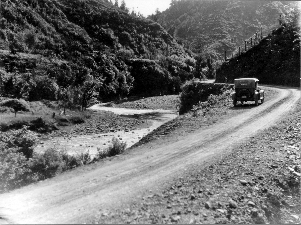
Waioeka Gorge Road in 1934
Photo by Una Garlick from Auckland Museum.
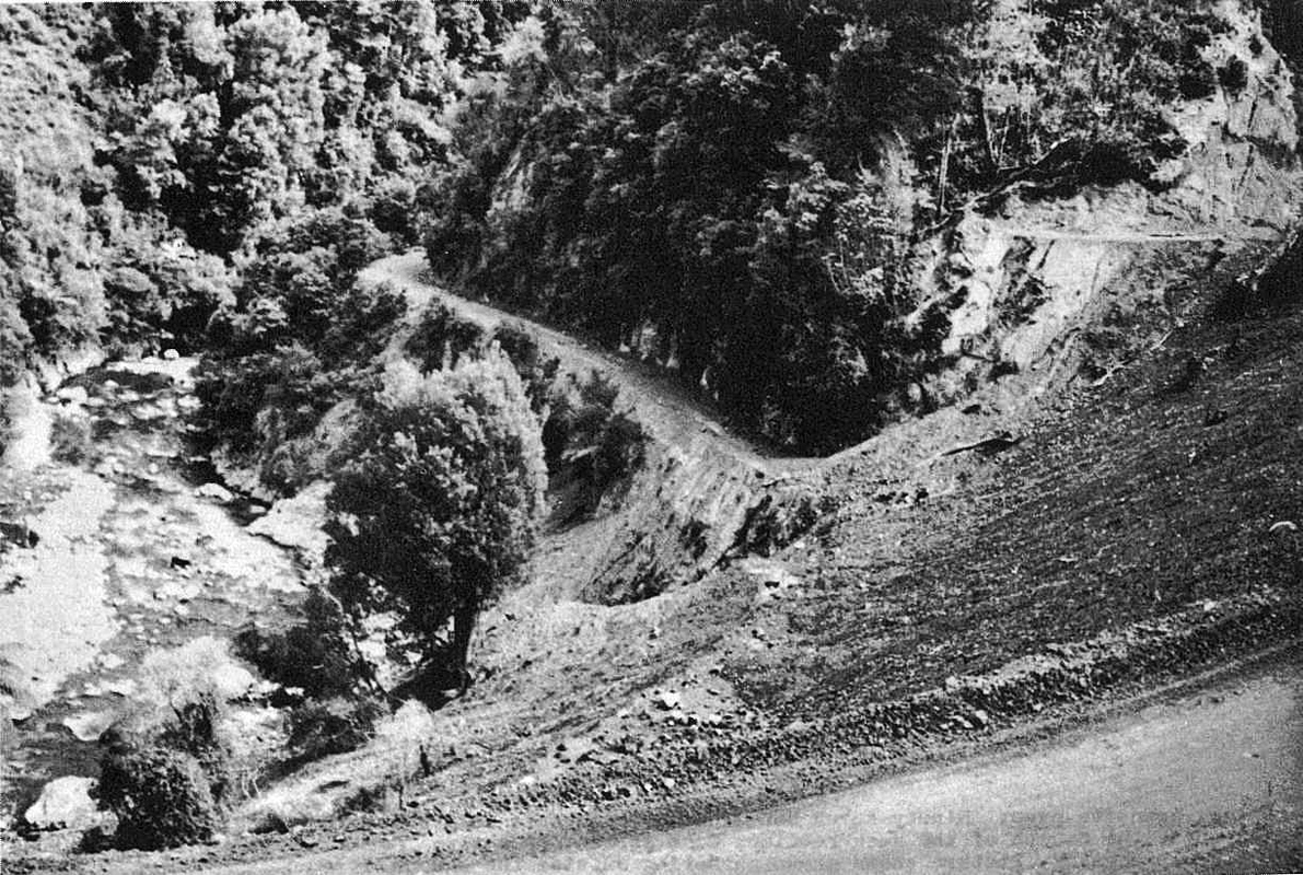
Waioeka Gorge Road in 1959
Photo of old road taken from the newly constructed highway.
From Gisborne Photo News.
Following wet weather the road was often closed by slips and rock falls. When the road was closed traffic used the Motu Road instead if it was open. The road continued to be used by drovers taking mobs of stock north from Gisborne, as shown in the 1937 photograph of sheep at Manganuku.
Although the reports above were very favourable, and an obvious improvement on the previous horse track, the road was still quite limited. The road was single lane, with several hairpin bends that required longer vehicles to stop and reverse to get the back wheels around. Many of the bends around bluffs were too narrow to pass another vehicle. When we drove from Matawai to Opotiki in the 1950s in my father's small Bedford truck there was a constant need to watch ahead for oncoming traffic so that a place wide enough to pass could be identified and stopped at. There were a couple of places you had to close the window to avoid getting wet from the waterfall coming down onto the road.
As a child I remember always being afraid going around the bluff at Wairata on the way to Opotiki, hoping not to end up in the river. I always looked down over the edge of the narrow road into the deep green river below. The location is shown in the photo labeled "Highway construction at Wairata 1960."
Two Lane Highway
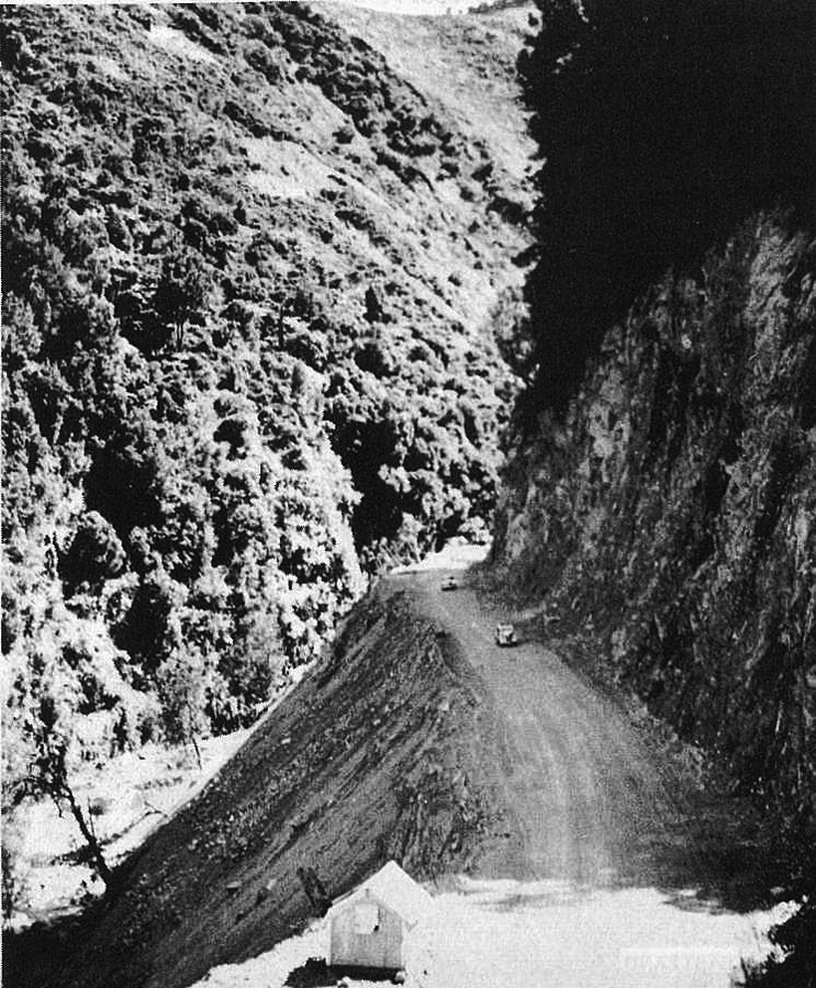
Newly constructed Waioeka Gorge Road in 1959
Photo of a section of the newly constructed highway.
From Gisborne Photo News.
As mentioned above, work to convert the single land Gorge Road to a two lane sealed highway began in 1950s. The Public Works Department established work camps at Matawai and Oponae and workers traveled from Opotiki. One camp was known as Chinatown, about 4 km from Matawai towards Opotiki, and consisted of 10 houses for workers and their families in 1962.
During construction travel times were longer, with motorists having to wait for blasting of rock and bulldozers pushing spoil down from cuttings made into the near vertical hillside so the road could be widened. Once a path had been cleared through the rubble traffic could proceed again.
The roadway was widened to two lanes all the way between Matawai and the Waioeka Pa, new bridges constructed, culverts installed to remove remaining open water courses, sharp hairpin bends removed and the road generally straightened. However, the steep terrain along the river meant that the highway still has a relatively large number of corners and care must be taken driving the route. Travel time from Matawai to Opotiki was approximately halved to about an hour compared with the previous road.
The highway was completed and opened officially on 15 December 1962. Photos below show the opening ceremony beside the Opato Stream near Wairata and the memorial to the three men who lost their lives while engaged in the construction.
Highway construction had taken more than 12 years. Forty kilometers (25 miles) of two lane highway had been carved through unstable near-vertical gorge along the tortuous path of the Waioeka River.
Since the official opening, the highway has required major repair works and been closed for periods due to flood damage and/or landslides. For example, in Feburary 1960 heavy rain overnight (190 mm at Matawai) caused flodding of the Opato that wasshed away 400 m of road and the approach to the bridge at the bottom of Traffords Hill leaving a 12 m gap. Heavy rain (500 mm in 24 hours at Oponae) in 1968 caused slips and washouts that closed the road for a week and required a further three weeks work to repair.
Highway construction at Wairata, 1960
The Waioeka River was eating away at the ramparts of the old highway (at lower left, passing round bluff) during a flood, so traffic was routed over the uncompleted highway at right. A grader is working on the road.
From Gisborne Photo News, 25 Feb 1960.
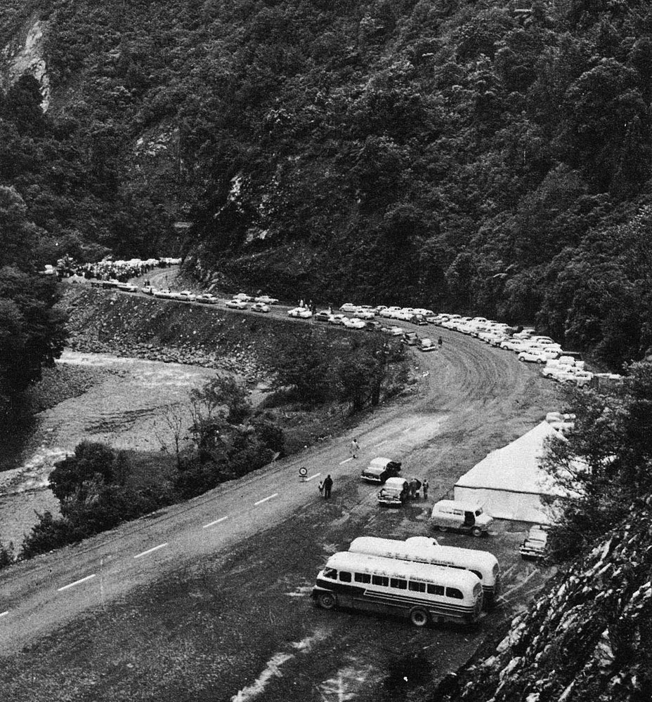
Official Opening of the Waioeka Scenic Highway, 1962
A crowd of about 400 attended the ceremony.
Photo from Gisborne Photo News.
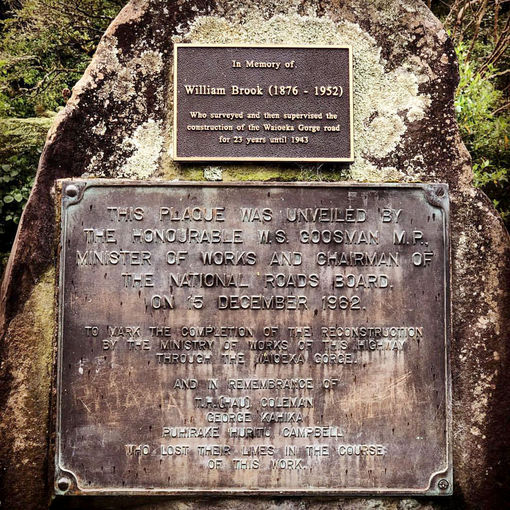
Plaque unveiled at official opening of the highway in 1962
Photo from Instagram.
Redpath Settlers
On 22 June 1906 The Evening Post reported the result of the Crown lands ballot for sections offered in the Opotiki County that day - "1235 acres at Waioha, George Redpath." This was one of five sections balloted at Waioha, in total 7,250 acres.
On 7 February 1907 the Poverty Bay Herald reported: Very successful burns (says the Opotiki Guardian) have been secured by Messrs McLean, Redpath, and other settlers in the Waioeka Valley, and teams of pack-horses are now busy conveying grass-seed on to their sections. Those who were fortunate enough to get their grass-seed sown before the recent heavy rains report that very little damage has been done, and are sanguine that a good take of grass will result. Considering the late period at which the ballot was held last year, a considerable quantity of bush has been felled, and is now in grass ready to be sown. This will mean an increased demand for stock in the winter. From present appearances labor will be more plentiful for bush-felling than was the case last year, and with the increased area to he taken up at the forthcoming ballot, a large amount of country at the back will be brought in.
The Poverty Bay Herald reported the results of the Opotiki Land Ballot on 15 August 1907. Amongst the successful applicants, who were required to attend the ballot, were:
- Section 1, block 3, 720 acres, 91 applicants, T. A. Redpath, of Rakauroa, Motu;
- Section 3, block 3, Waioeka South, 1380 acres, five applicants, John Redpath, Rakauroa, Motu.
The following account of the Redpath family settlement in the Waioeka Gorge was provided by the late Charlotte Cameron (nee Redpath).
The first ballot for sections in the Waioeka Gorge was held in Opotiki in 1907. Rueben Watson, who later married Allie, drew one section at Oponae, and Father drew one at Omaukora. In the next ballot the following year Tom (22 years) and Jack (20 years) drew adjoining sections at Wairata.
The Omaukora Stream and valley run north of where Omaukora is marked on the map. Tom and Jack's sections were on the western side of the Waioeka River, up the valley from Wairata. The location of Jack's house above the river is marked on the map as Redpaths. The Redpath family were farming at Rakauroa at the time the land was obtained in 1907.
Each year an area of bush was felled and burnt, and immediately sown with grass seed. It was a long tiring journey getting stock through to the Waioeka Gorge from Rakauroa. The only route was through Matawai, 5 miles north of Rakauroa and now well settled, through Motu to Toatoa, where there was not even a track, on to Opotiki and back into the Gorge. Very heavy bush covered the hills, especially between Matawai and Toatoa, and stock was lost on the way.
In January 1909, Mother and Charlotte went over to Omaukora, via Motu and Opotiki, riding all the way. Father had built a whare and planted an orchard, which was there for many years. Father, Tom and Jack were felling bush at Wairata, so Mother and Charlotte rode up to spend a day with them. For lunch the boys had made a pumpkin pie, which is still remembered.
Allie was married to Rueben Watson at Rakauroa in 1910. Following the reception they rode through to their new home at Oponae. In July 1911 Allie and Rueben's daughter, Grace, was born.
In January 1912, Father and Charlotte rode to Oponae, via Motu and Opotiki, to stay with the Watson family. While there, Allie, Charlotte and baby Grace rode to visit the Creugnet's, a French couple who lived next to the Omaukora farm. They were farming there for a few years only, before moving to Opotiki.
In February 1912 Mother and Min rode to Watson's at Oponae (via Motu and Opotiki). After spending a week or two there they decided to walk through to Matawai, approximately over a route which was planned to make a shorter track into the Gorge. Several men, Rueben Watson may have been included, accompanied them, and when they departed quite a small crowd appeared to farewell the party. The first night was spent at McAuley's, next to Tom and Jack's farm at Wairata, and it is thought that another two nights were spent on the journey before they came out onto the road which had been formed to near the present Korte homestead. Presumably, they were met there and transported back to Rakauroa.
By August 1912 a track of sorts had been formed through the Gorge from Matawai to Oponae, and Mother and Charlotte were able to ride through from Rakauroa in one day. While they were there Allie developed rheumatic fever. Mother stayed to nurse her and Charlotte returned home with Jack. Due to heavy rain the track was very rough, and it was not a easy journey.
Allie and Rueben's son, Tom, was born in a nursing home at Opotiki in April 1913. Allie was very ill due to the rheumatic fever she had suffered the previous winter, and also goitre trouble. She died when Tom was just two weeks old, and a fortnight later Mother and Jack brought Grace and the baby home to Rakauroa.
Rueben remarried in February 1915 and then collected Grace and Tommy to live at Oponae.
In 1916 Jack purchased a new stove for his home, it arrived at Rakauroa in a large packing case. It had to be unpacked, then each part was carefully wrapped in sacks and bags, and then weighed, before being sent on pack horses through to his new home at Wairata.
Charlotte went to stay with Jack and his wife Bell at Wairata in January 1917. Shearing was finished. The wool was packed into bags, strapped onto pack horses, 22 of them, then taken to a wool-shed about 15 miles towards Opotiki. There it was pressed into wool bales and taken by lorry to Opotiki.
Charlotte and husband Corry would take a holiday in summer at Wairata in their old age, camping beside the Waioeka River. They fished trout from the river and enjoyed the scenery. I recall our family calling in on their camp amongst the bush.
Tauranga Bridge
The Tauranga Bridge was built to provide access to the farms in the Tauranga Valley on the western side of the Waioeka River. The valley was subdivided (4 farms) in 1906 and settled under a government scheme to create farms from unproductive forest land. The rugged landscape proved unsuitable for farming and the settlers struggled with the difficult conditions. Ultimately the farms failed and from the late 1920s farmers began to abandon their properties. The abandoned farmland is now part of the Waioeka Gorge Scenic Reserve.
In 1918 a flood swept away the original suspension bridge across the Waioeka River. A temporary crossing was used until 1922 when the Public Works Department built the present bridge.
By the 1970s when farming in the valley had been abandoned, vehicles stopped using the bridge, and it was no longer maintained. By the 1990s, the bridge was near to collapse. However, in 1994 significant structural work was carried out on the bridge, followed by further restoration in 1996 and subsequent maintenance.
From a tower at one end, each suspension cable passes under a different bridge crosspiece, before rising to the tower at the other end. This creates an unusual and attractive 'harp-like' pattern, hence the term harp suspension bridge.
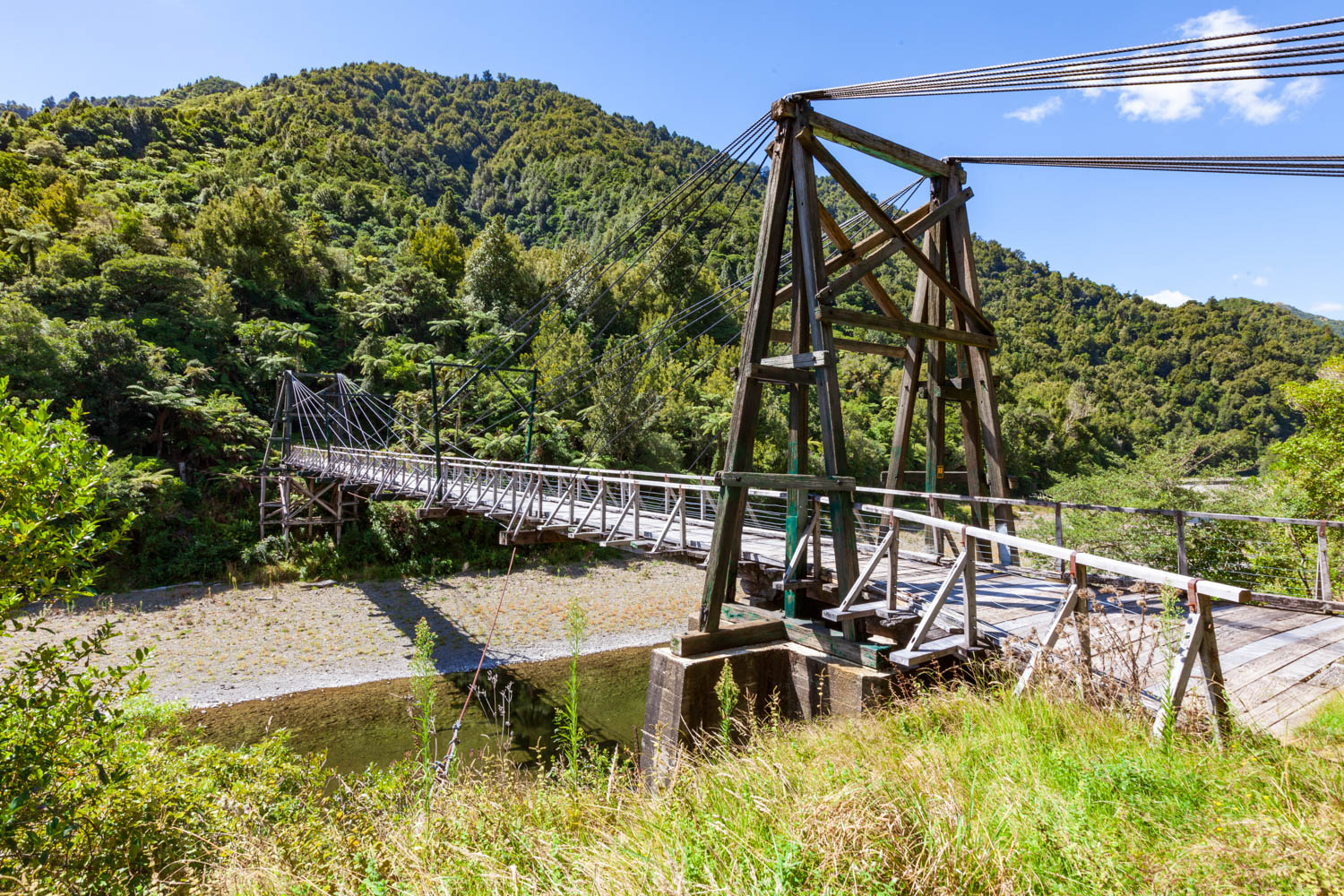
Tauranga Bridge in 2014
Photo from Western side of river showing regrowth bush above the Highway.
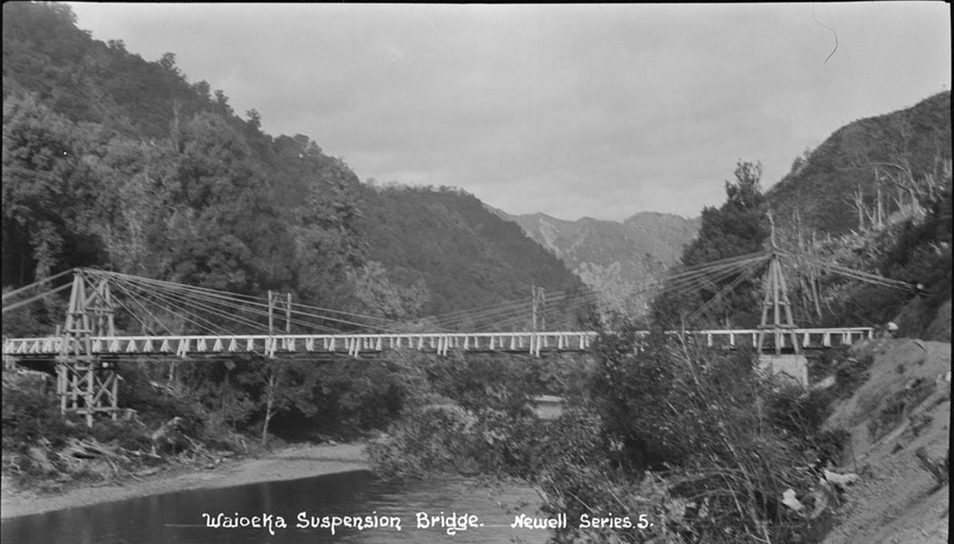
Tauranga Bridge
From Auckland Libraries Heritage Collections, 35-R2170.
The Tauranga Loop Track (2 hours walking track) is over the Tauranga Bridge on the western side of the Waioeka River. The track is through regenerating farmland on the southern side of Tauranga Stream, then crosses the stream to the northern bank, and doubles back along the bush edge to the Waioeka River. There is a second stream crossing at the mouth of the Tauranga Stream to get back to the Tauranga Bridge.
Oponae
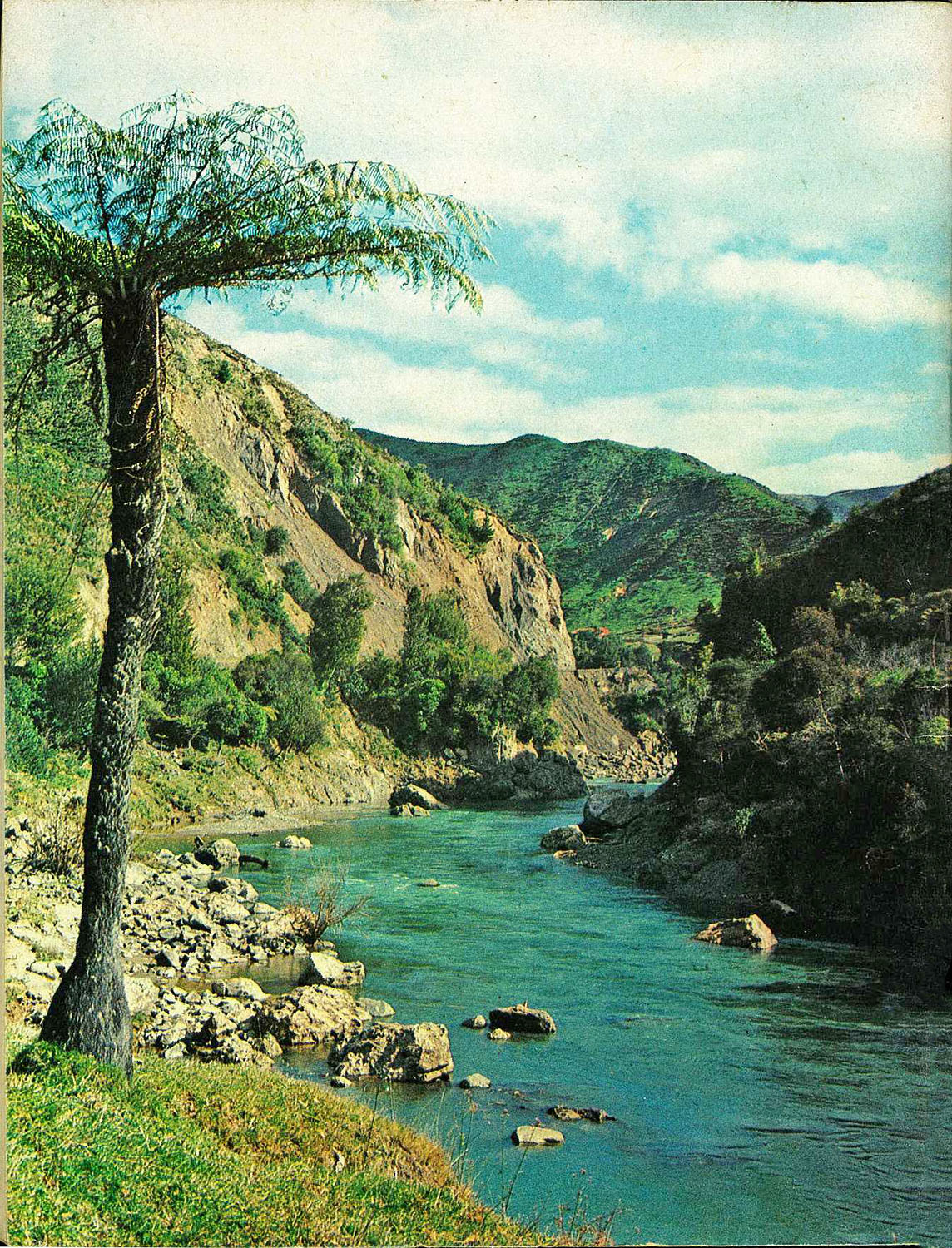
Waioeka River at Oponae, 1965
Photo taken on Opotiki side of Oponae. Farm buildings on the western side of river.
From Gisborne Photo News, 6 Oct 1965
With the arrival of settlers in the Waioeka Gorge, a store and post office had opened at Oponae by 1912 and there were 19 households listed in the 1912 Wise's Post Office Directory for Oponae. Mail and stores came the last 14 miles from Opotiki to Oponae by pack horse as the road had only reached Matahena in 1912. The Post Office Directory indicates the number of farming household in the Waioeka around Oponae and Wairata, with 22 in 1922, then a decline to 5 properties by 1936 as farmers abandoned their land. There were 5 farming properties listed in the 1943 Oponae directory and the post office had closed by 1946, remaining residents getting mail from Opotiki.
Oponae was the location of a small Ministry of Works settlement, Midway Camp, during highway construction in the 1960's. An aerial photo taken in 1964 shows Oponae and the camp had 5 houses and 17 small buildings used for road construction worker accommodation.
A bridge over the Waioeka River at Oponae gives access to land on the western side of the river in the Oponae and Waiata Stream valleys. Seven sections were originally surveyed for farms over the river at Oponae, with the Waiata Road providing access. Most of this farmland on the western side of the river was planted in pine forest in the 1980s. The first forest harvesting operation took seven years and was completed in 2018. It involved felling 186,000 trees and harvesting 318,000 tonnes of timber.
Wairata
An map of Whakatane County published 1894 shows the location of Tahora Pa at Wairata, located on the western side of the river opposite the mouth of the Opato Stream.
Wairata is at the junction of Waioeka River and the Opato Stream. The bridge that crosses the Opato stream was opened in March 1932, giving road access to the properties on Wairata Road and Redpath Road. Wairata School and school house were located over the bridge above the Opato Stream. The school closed in 2001. Wairata Station offers cottage and chalet accommodation, campervan parking, hosts who are keen anglers, access to some great fishing, and a fishing guide if required.
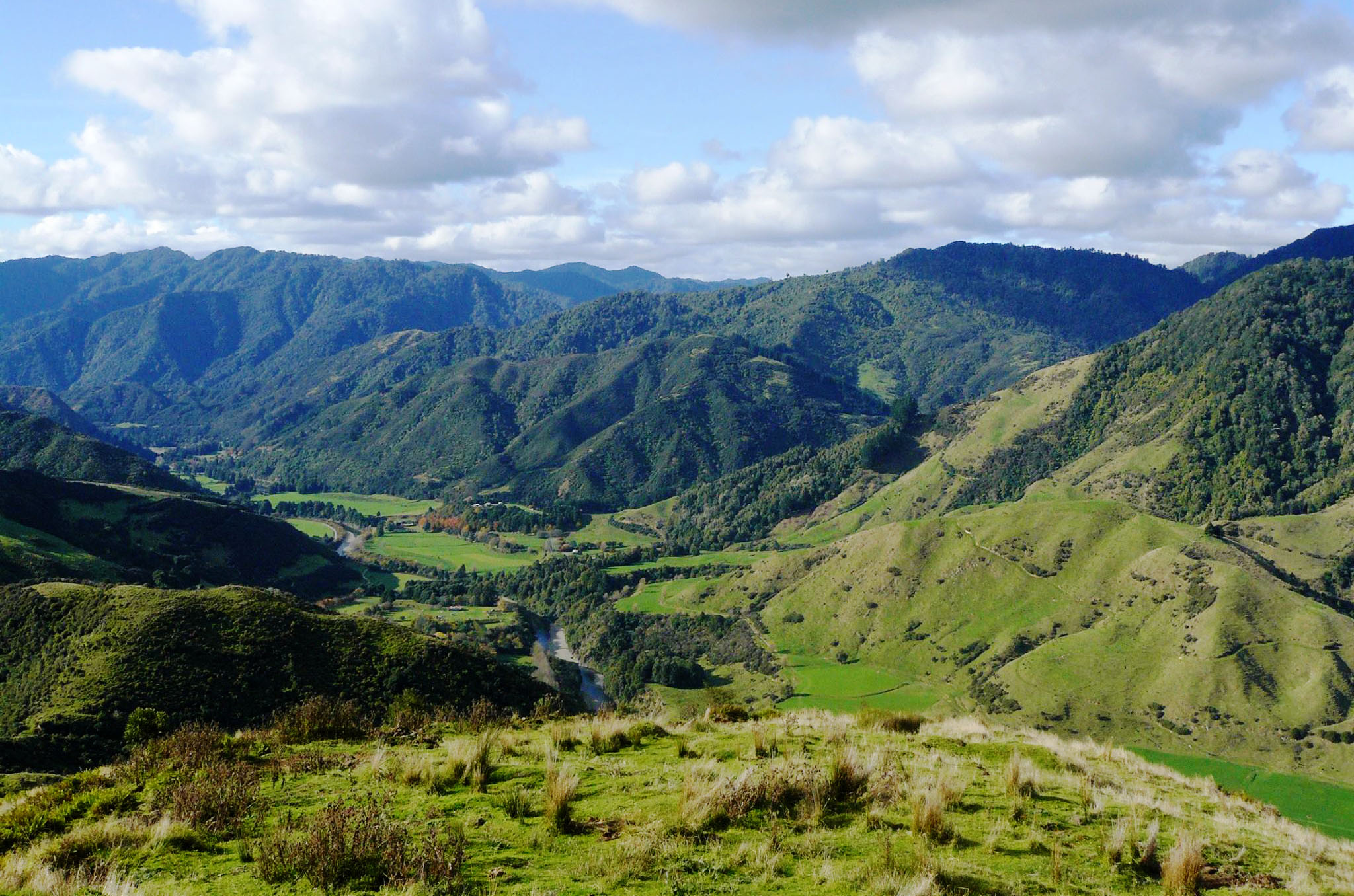
Farmland in Waioeka Valley at Wairata
This view is from Wairata Station, to the east down the river towards Wairata.
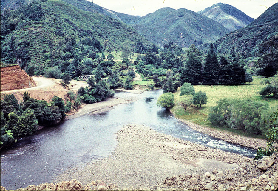
View west up the Waioeka River and valley at Wairata in 1960
The Opato Stream (bridged) joins the Waioeka River at Wairata. The school (not visible) was in the trees over the bridge above Wairata Road.
Manganuku
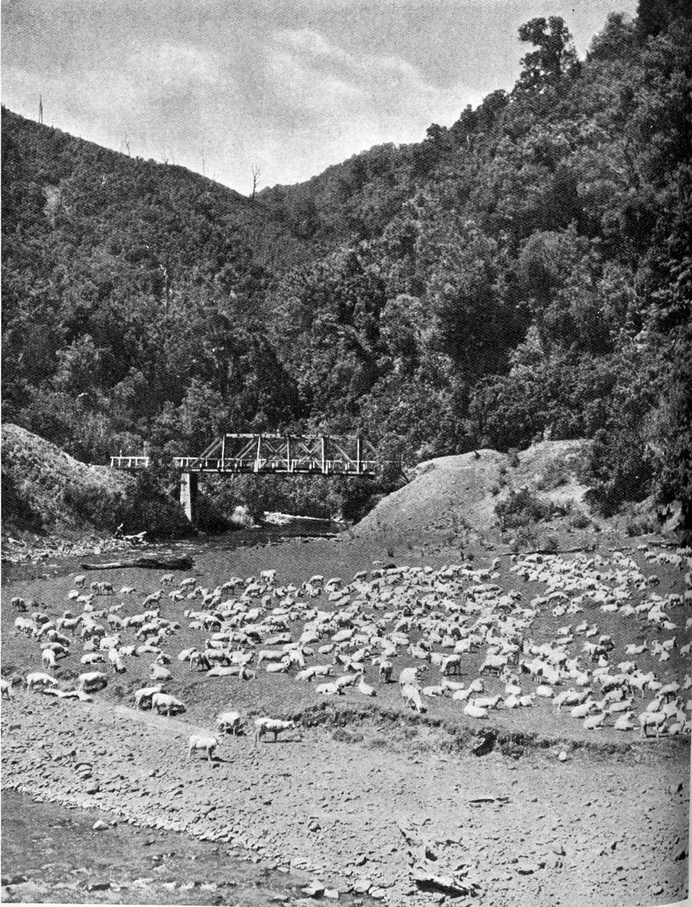
Sheep at Manganuku
From Auckland Weekly News 24 Feb 1937.
Poverty Bay sheep en route to the Waikato.
Manganuku is where the Manganuku Stream joins the Opato Stream. The road built in the 1930s took a short loop up the valley to the single lane bridge shown in the photo, around an area surveyed for a stock reserve and school site. No school was built but the area was used by drovers going through the gorge for overnight stops, with flat areas for a camp and grass and water for stock. The area was also used for picnics, swimming and camping. Today the Manganuku Campsite is located there.
When I was growing up our family regularly had a picnic at Manganuku on New Years Day. We would swim in the Opato Stream which was warm enough for swimming at that time of year. My Dad would point out the pine trees above the road on the Opotiki side of the Manganuku Stream where the Gibson's farm buildings were located before the farm was abandoned in 1934 due to the depression.
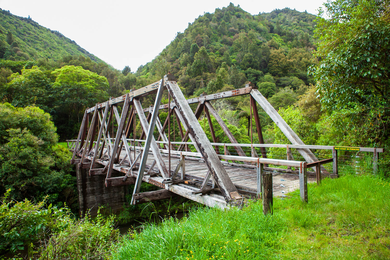
Manganuku Bridge
The single lane 24 m bridge was built of hardwood in 1929 and retired in 1965 when the new highway bridge was opened.
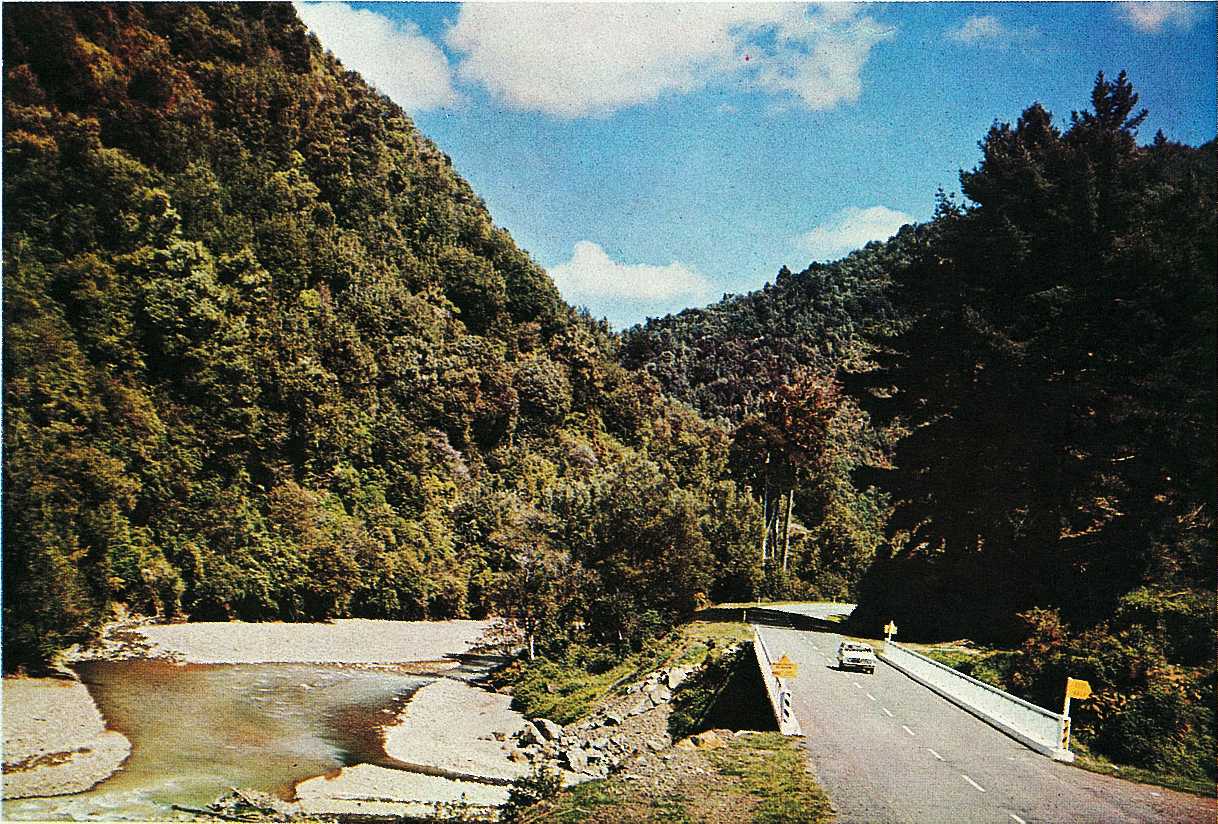
Manganuku Bridge, 1968
Highway bridge constructed when the gorge road was upgraded. Pine trees planted by the Gibsons on right of photo. Opato Stream on left.
Trafford's Hill
Trafford's Hill is named after the settlers who lived at the foot of the hill on the Opotiki side. The point marked Traffords Hill on the map is the summit (700 m altitude).
Near the summit of Trafford's Hill the Public Works Department operated a quarry for many years to supply metal for highway construction. The quarry was closed after the highway was completed.
The Matawai side of Traffords Hill is farmed. The Opotiki side is covered in fern and reverting bush, with pine trees below part of the road to stabilise the slope.

View north from Trafford's Hill, 2014
This view is from near the top of Trafford's Hill, on the Opotiki side. The pasture on the hill in the center of the photo is on the Trafford farm, and the farm buildings are below the hill with pasture (in the center of the photo) are on the other side of the Highway.
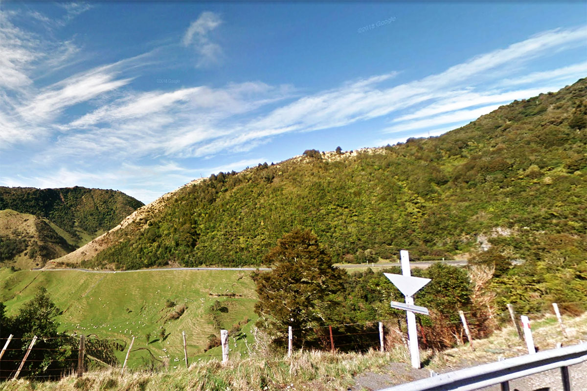
View from top of Trafford's Hill
The view shows the road towards Matawai. The rock face above the road on far right is the site of the closed quarry.
Page last updated on 17 June 2019.


